Monday, September 06, 2004
NOAA Satellite Image of Hurricane Frances as it Approaches the East Coast of Florida
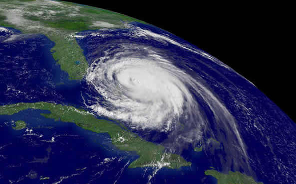 A National Oceanic and Atmospheric Administration oblique satellite image shows Hurricane Frances approaching the southeastern coast of Florida, taken at 11:15 a.m. EDT September 3, 2004.
These images are from the NOAA GOES-12 environmental satellite, which is in geosynchronous orbit about 22,300 miles above the Earth, high enough to allow the satellites a full-disc view of the Earth.
Because these satellites stay above a fixed spot on the surface, they provide a constant vigil for atmospheric 'triggers' for severe weather conditions such as tornadoes, flash floods, hail storms and hurricanes.
Powerful Hurricane Frances roared through the Bahamas Friday and took aim at the crowded southeast Florida coast, where hundreds of thousands of people fled their homes as much of the state shut down.
Story by NOAA/GN
Photo by HO
REUTERS NEWS PICTURE SERVICE
Comments:
Post a Comment
![]()